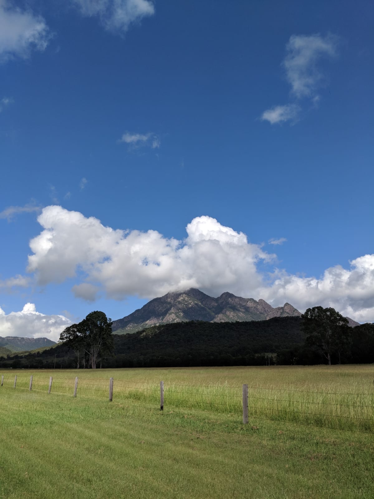
This weekend we decided to embark on a slightly more intense trek and found that Mount Barney National Park had a range of different tracks on offer. Considering the drive to Mount Barney was going to take nearly 2 hours, we decided to embark on the 3 hour Lower Portals track and set off before 8am (we are still beginners after all!)
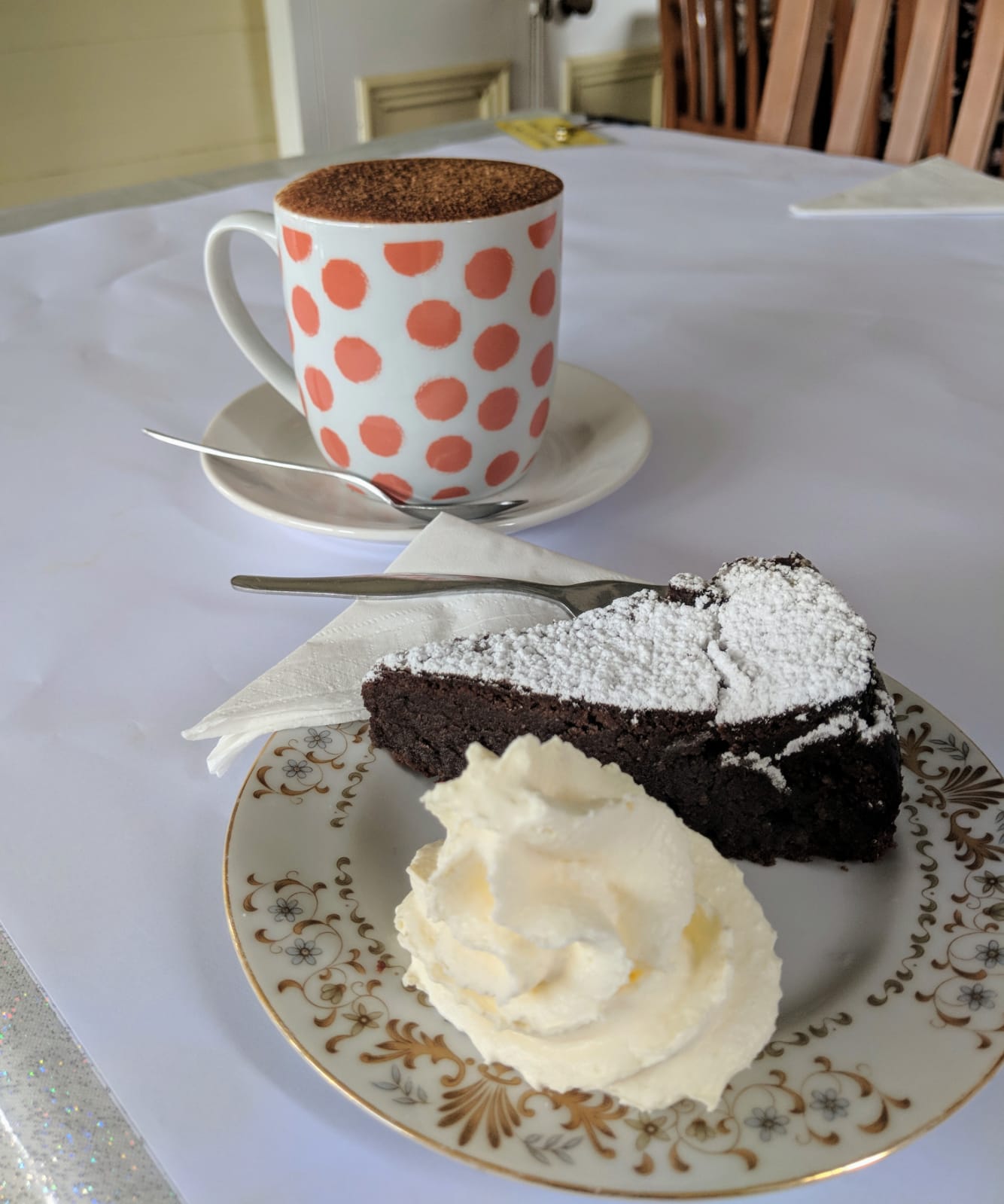
Driving down from Brisbane we planned to stop for our ritual pre-trek breakfast at Rathdowney on the Mount Lindsay highway. Just outside of the town centre is Rathlogan Grove with its very own Hilltop cafe nestled amongst the olive trees. The cafe is quite charming with its rural surrounds and small store selling a range of goods from country kitchen wares and boutique skincare to their very own olive oils and dressings (of which we purchased a few). Although their menu didn’t clearly state gluten-free options, they were more than happy to provide gluten-free bread which turned out to be of the best handmade variety.

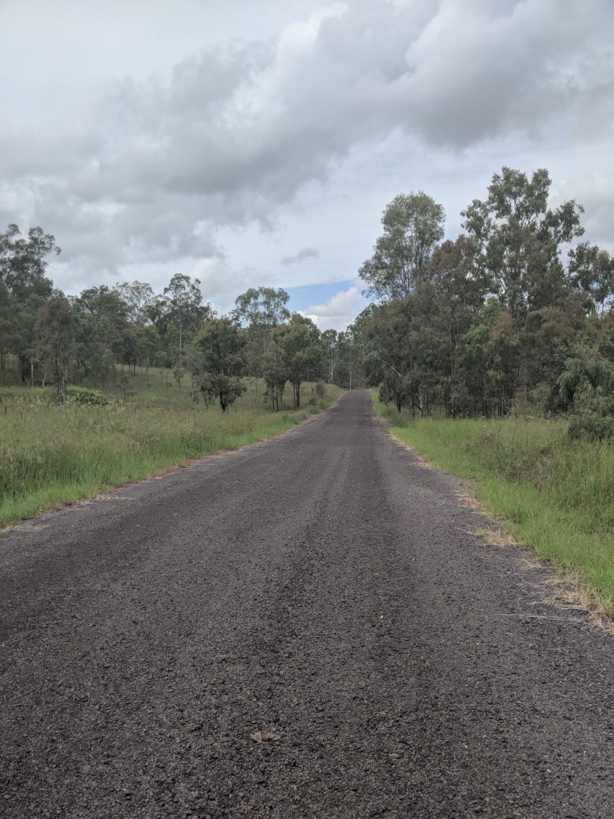
After fuelling up, we made our way to the start of the trek at the Lower Portals car park in Mount Barney National Park. As Upper Logan Road steadily transformed into a dirt track, we were baffled as to where the Lower Portals car park actually was and ended up at Yellow Pinch Reserve.

At this point in time we had both lost mobile signal so we were without navigation. Luckily for us, there were some handy (though no very detailed) maps at the Yellow Pinch Reserve notice board and we discovered we’d somehow driven past Lower Portals road.

We eventually found Lower Portals car park (the sign for Lower Portals Road was obscured by a sign for Barney Creek Vineyard Cottages!) put on our hiking boots and headed out on the track. The Lower Portals track is a class 4 track (based on Australian standards) with a distance of 7.4km return – taking around 3 hours in all.

The track itself had a mixture of terrains, with some very steep inclines and a small amount of rock climbing at points. What started off as a fairly cloudy and cool day quickly turned into a very hot and humid one – add steep and uneven tracks in the mix and you’ve got yourself a recipe for a sweaty hike!
Despite the intensity, there seemed to be a great mixture of people attempting the hike including young children and some elderly folks (who we were unsure were going to make it to the end!) Matt described some parts of the track as an ‘arid hellscape’ with the red-orange rocks and tree roots engulfing the steepest inclines. It was certainly a step up from our trek at Lake Wivenhoe!

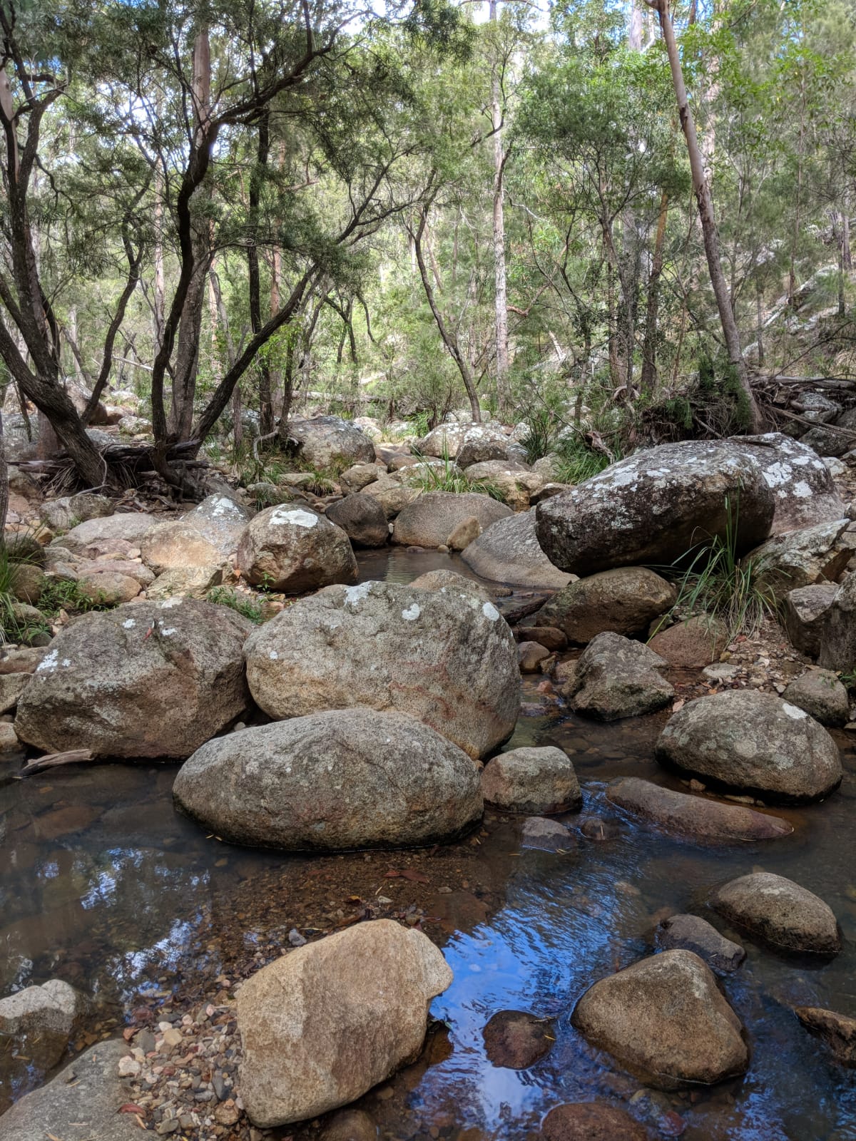
After around 1 hour and 20 minutes of ups and downs we reached the creek at the end of the track (hurrah!). I was surprised that the creek was so clear and clean and began to regret not taking any swimwear with me (I was pretty hot and sweaty by this point!)
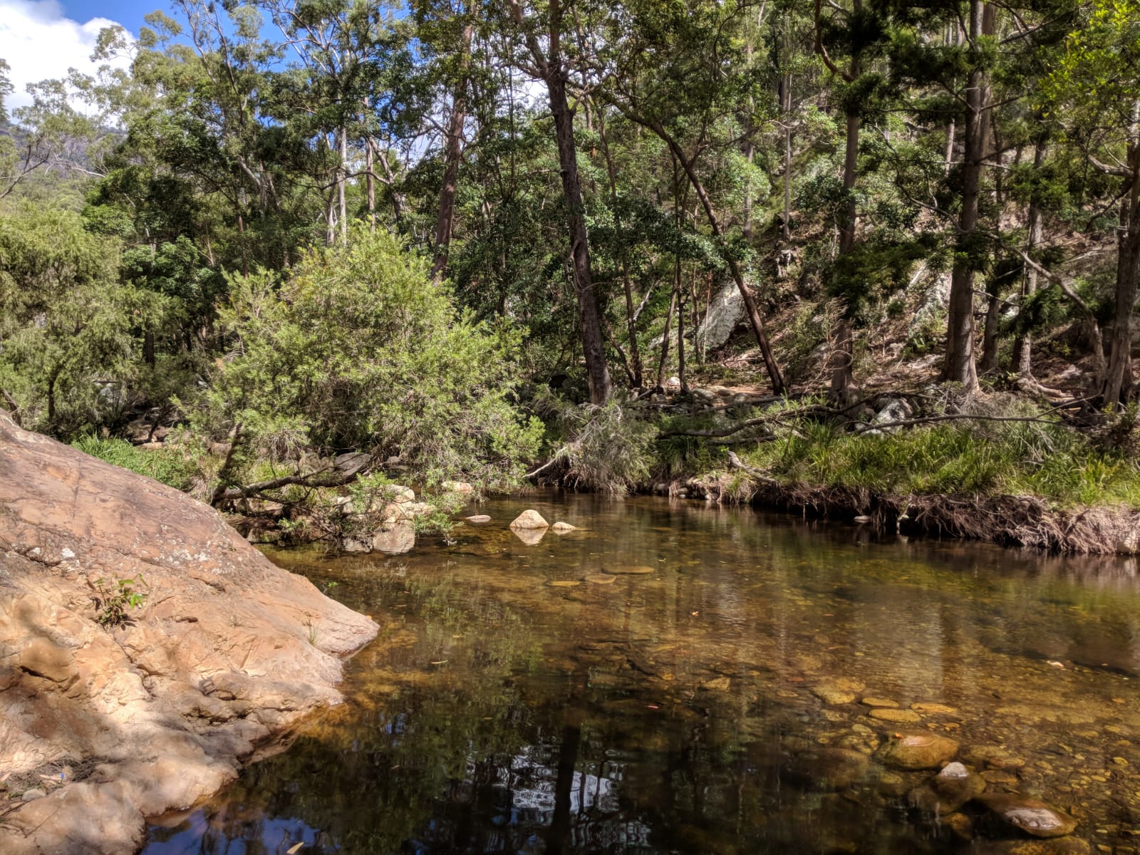
Although you can swim at the first point of the creek (the first part is surprisingly quieter), you have to jump over the stepping stones and clamber over some rocks on the other side to reach the more popular swimming holes.

Here we found congregations of families and friends eating picnics, enjoying a swim and sunbathing on the many rocks. After removing socks and shoes and dipping our feet into the water, we both decided that we probably wouldn’t have been swimming after all – the pool was freezing cold even despite the heat! Despite the large amount of people there, the creek had a rather relaxing vibe to it. We even saw a wild turtle milling around in the water, keeping its distance from the splashing children.

Overall, the trek was quite intense in terms of the steep inclines, high humidity and temperatures, but thoroughly enjoyable all the same! The track provides an array of different scenery and terrains meaning you’ll never get bored of repetition and the creek at the end is just an added bonus! Ensure you take plenty of water, optional swimwear and perhaps a picnic to enjoy once you reach the creek. Expect to be out for at least 4 hours so remember your sunscreen and protective gear. Oh and bear in mind there’s little to no mobile phone signal so make sure you download your offline maps beforehand.
Have you recently completed a Mount Barney trek? We’d love to hear from you!
Happy hiking! 🙂